Health authorities in Peru presented the Geospatial System of Integrated Health Networks (GeoRis) as part of the latest update of the National Single Repository of Health Information (Reunis).
The Reunis is a database of the Peruvian Ministry of Health (Minsa), which contains information from the General Directorate of Health Insurance and Service Exchange (Dgain). Its most recent update incorporates the Geospatial System of Integrated Health Networks (GeoRis), a platform that allows the public to access information related to Integrated Health Networks (RIS) and the location of facilities that perform COVID-19 tests.
According to the Ministry of Health (Minsa), GeoRis “collects, analyzes, identifies, and interprets primary and secondary information from different inter-institutional sources in Peru, enabling the georeferencing (use of geographic coordinates to assign an exact spatial location) of the RIS. It is recommended to watch the video tutorial beforehand for proper use of the application.”.
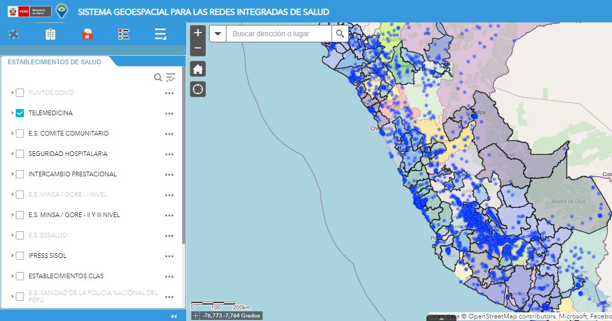
The platform allows you to apply various filters, for example, to search for EsSalud establishments, IPRESS, health centers with services of telemedicine, Among other things, it is also possible to measure distances in different units of measurement between different health units and facilities, as well as to measure square meters of selections made on the map and consult the latitude and longitude of each location.
Likewise, the new platform will progressively incorporate new tools and functions, as well as methodological designs that favor the implementation of RIS in the country.
Check out this new tool at the following link: https://georis.maps.arcgis.com/apps/webappviewer/index.html?id=cd948f7a5ab241a1a1c75d867e7526fd