Adolescente de 14 años crea mapa sobre casos de COVID-19 en México utilizando la plataforma MyMaps de Google.
Miguel Ángel López Ortega, adolescente mexicano de 14 años, utilizó la plataforma de MyMaps de Google que permite la creación de mapas personalizados y los datos del gobierno federal para crear un mapa con los casos a nivel nacional de COVID-19.
En el Mapa se pueden consultar el número de casos confirmados de COVID-19 en cada estado de la república, así como en las principales ciudades afectadas. Además, existe la opción de ver la lista completa de casos por estado.
Los estados aparecen en tonos diferentes dependiendo del número de contagios confirmados, para identificar los estados con mayor número de casos de una manera más rápida. El mapa también muestra de una manera sencilla el número de casos sospechosos y casos negativos en todo el país.
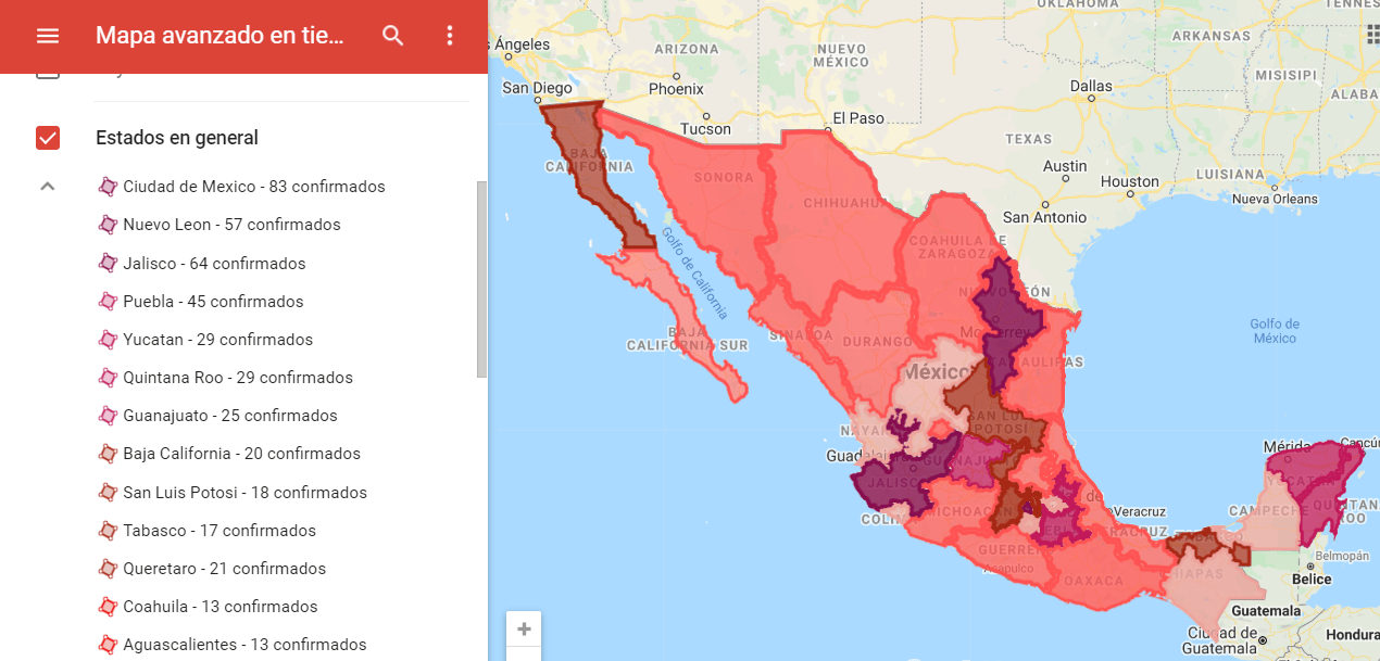
You can view the map in the following link, the map is constantly updated with the official numbers of each state and the federal government information:
https://www.google.com/maps/d/viewer?mid=1-XnTNpU7R4XiVewJh_nwcpUrtGgd4gwu


