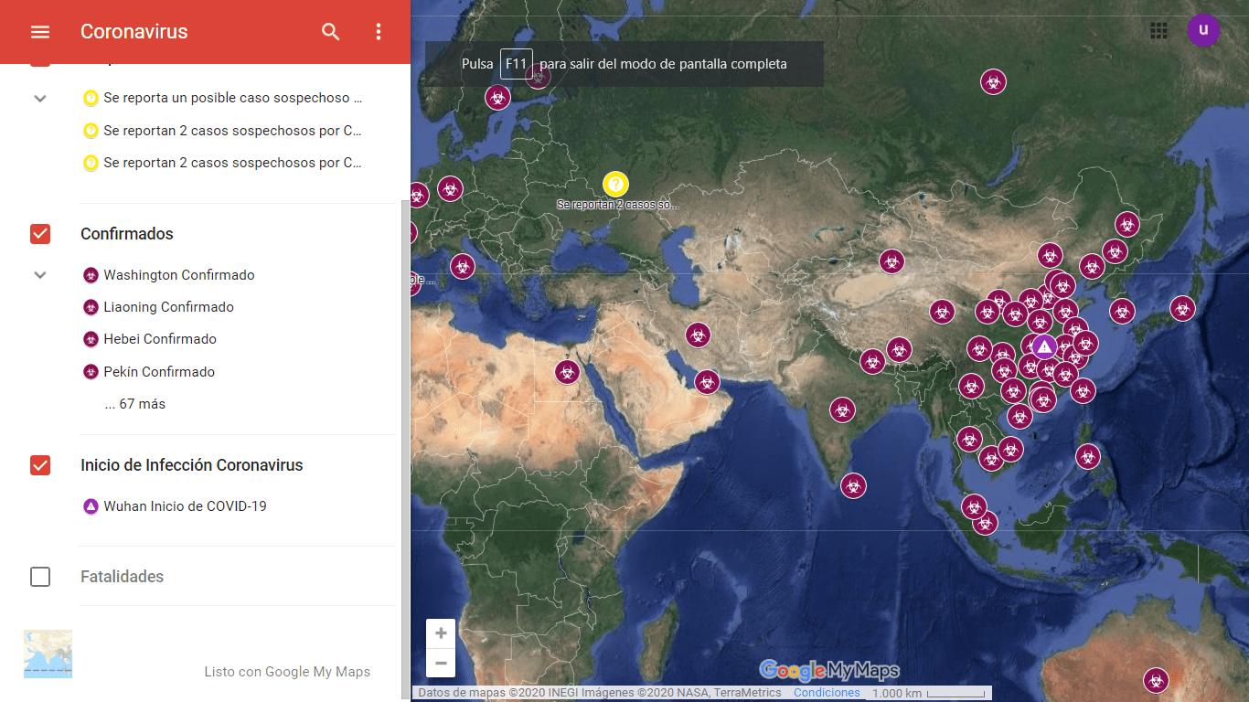
El mapa, que utiliza tecnología de My Maps, muestra en tiempo real los puntos donde existen casos confirmados con coronavirus y los lugares que cuentan con posibles casos.
El 22 de enero de este año, se lanzó un mapa interactivo que muestra los países donde existen casos confirmados de coronavirus, señala a aquellos con posibles contagios e identifica las ciudades en donde se han registrado pérdidas humanas.
El mapa que se actualiza en tiempo real, marca –con un ícono de precaución– a la provincia de Wuhan, como el principio del brote de la infección coronavirus (COVID-19).
Además, cuenta con otros tres íconos que establecen diferentes situaciones en el mapa, un ícono morado indica los casos confirmados a nivel global, un icono rojo oscuro marca las fatalidades y un icono amarillo indica los posibles casos.
Actualmente la lista de defunciones incluye 26 ciudades y países, por otra parte, la de casos confirmados asciende a 71 ciudades y naciones según muestra el mapa.

En la navegación del mapa se permite ocultar o mostrar cada una de las cuatro categorías para facilitar su visualización, además se puede insertar en cualquier sitio web con HTML y cuenta con más de 25 millones de visitas hasta el momento.
We invite you to enter the map and keep you informed in real time:
NEVERTHELESS


